Compartir
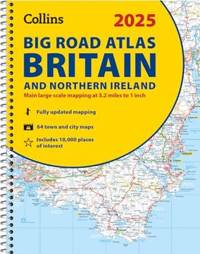
2025 Collins big Road Atlas Britain and Northern Ireland: A3 Spiral (en Inglés)
Collins Maps (Autor)
·
Collins
· Tapa Blanda
2025 Collins big Road Atlas Britain and Northern Ireland: A3 Spiral (en Inglés) - Collins Maps
$ 96.023
$ 152.417
Ahorras: $ 56.394
Elige la lista en la que quieres agregar tu producto o crea una nueva lista
✓ Producto agregado correctamente a la lista de deseos.
Ir a Mis Listas
Origen: Reino Unido
(Costos de importación incluídos en el precio)
Se enviará desde nuestra bodega entre el
Jueves 30 de Mayo y el
Miércoles 05 de Junio.
Lo recibirás en cualquier lugar de Colombia entre 1 y 5 días hábiles luego del envío.
Reseña del libro "2025 Collins big Road Atlas Britain and Northern Ireland: A3 Spiral (en Inglés)"
Explore Britain with easy-to-read mapping from Collins. The ultimate 3.2 miles to 1 inch scale large-format, spiral-bound road atlas of Britain, featuring Collins' popular and well established road mapping, and designed for exceptional clarity and ease of use. The atlas has a wide range of urban area maps at even larger scale and 64 detailed town center street plans. This fully updated road atlas covers the whole of Britain with each scale of mapping color-coded for ease of use. The smallest scale maps are great for long distance route planning and the street plans help you locate your final destination. Main features: Easy to use, clear road maps at a scale of 3.2 miles to 1 inch of England, Wales and Southern Scotland. Northern Scotland is shown at 5 miles to 1 inch Route planning section including maps at a scale of 15.8 miles to 1 inch, motorway services information and a handy distance calculator 22 urban area approach maps at 1 mile to 1 inch which clearly show the best routes through and into urban areas 64 street maps focused on town centers showing places of interest, car park locations and one-way streets Updated Park & Ride locations, new rail stations and extensions to tram lines in Blackpool and Edinburgh Over 30 categories of places of interest including castles, theme parks, sports venues and surfing beaches Full postcodes for the top 1000 places of interest - ideal for use alongside sat-nav systems
- 0% (0)
- 0% (0)
- 0% (0)
- 0% (0)
- 0% (0)
Todos los libros de nuestro catálogo son Originales.
El libro está escrito en Inglés.
La encuadernación de esta edición es Tapa Blanda.
✓ Producto agregado correctamente al carro, Ir a Pagar.

