Compartir
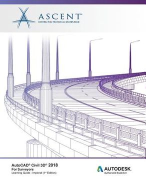
AutoCAD Civil 3D 2018 For Surveyors - Imperial: Autodesk Authorized Publisher (en Inglés)
Ascent -. Center For Technical Knowledge (Autor)
·
Ascent, Center for Technical Knowledge
· Tapa Blanda
AutoCAD Civil 3D 2018 For Surveyors - Imperial: Autodesk Authorized Publisher (en Inglés) - Ascent -. Center for Technical Knowledge
$ 339.815
$ 566.358
Ahorras: $ 226.543
Elige la lista en la que quieres agregar tu producto o crea una nueva lista
✓ Producto agregado correctamente a la lista de deseos.
Ir a Mis Listas
Origen: Estados Unidos
(Costos de importación incluídos en el precio)
Se enviará desde nuestra bodega entre el
Martes 02 de Julio y el
Martes 16 de Julio.
Lo recibirás en cualquier lugar de Colombia entre 1 y 5 días hábiles luego del envío.
Reseña del libro "AutoCAD Civil 3D 2018 For Surveyors - Imperial: Autodesk Authorized Publisher (en Inglés)"
This in-depth AutoCAD(R) Civil 3D(R) 2018 for Surveyors learning guide is for surveyors and survey technicians that do not necessarily need all of the functionality that is taught in AutoCAD Civil 3D Fundamentals. This learning guide equips the surveyor with the basic knowledge required to use AutoCAD Civil 3D efficiently in a typical daily workflow. Students learn how to import the converted field equipment survey data into a standardized environment in AutoCAD Civil 3D and to use the automation tools to create an Existing Condition Plan. Data collection, and traverses are also covered. Other topics that help in increasing efficiency include styles, correct AutoCAD(R) drafting techniques, the methodology required to create linework effectively for variables used in defining symbology, surfaces, categorizing points, and importing imagery.Topics Covered The AutoCAD Civil 3D InterfaceThe Planning and Analysis workspacePoints overview and stylesImporting points and coordinate transformationsCreating points and draftingPoint groups, grips, and reportsPoint security and editingIntroduction to data collection in the fieldIntroduction to Civil 3D Survey and automated lineworkSurvey networksCoordinate Geometry Editor for entering traverse information or legal descriptionsSurface overviewSurface editingSurface labels and analysisPoint clouds and creating a surface from point cloud data Prerequisites Previous experience with the AutoCAD software and a basic understanding of the Surveying profession is recommended.
- 0% (0)
- 0% (0)
- 0% (0)
- 0% (0)
- 0% (0)
Todos los libros de nuestro catálogo son Originales.
El libro está escrito en Inglés.
La encuadernación de esta edición es Tapa Blanda.
✓ Producto agregado correctamente al carro, Ir a Pagar.

