Compartir
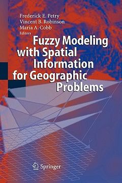
fuzzy modeling with spatial information for geographic problems (en Inglés)
Frederick E. Petry
(Ilustrado por)
·
Vincent B. Robinson
(Ilustrado por)
·
Maria A. Cobb
(Ilustrado por)
·
Springer
· Tapa Blanda
fuzzy modeling with spatial information for geographic problems (en Inglés) - Petry, Frederick E. ; Robinson, Vincent B. ; Cobb, Maria A.
$ 907.743
$ 1.650.441
Ahorras: $ 742.699
Elige la lista en la que quieres agregar tu producto o crea una nueva lista
✓ Producto agregado correctamente a la lista de deseos.
Ir a Mis Listas
Origen: Estados Unidos
(Costos de importación incluídos en el precio)
Se enviará desde nuestra bodega entre el
Jueves 30 de Mayo y el
Jueves 13 de Junio.
Lo recibirás en cualquier lugar de Colombia entre 1 y 5 días hábiles luego del envío.
Reseña del libro "fuzzy modeling with spatial information for geographic problems (en Inglés)"
The capabilities of modern technology are rapidly increasing, spurred on to a large extent by the tremendous advances in communications and computing. Automated vehicles and global wireless connections are some examples of these advances. In order to take advantage of such enhanced capabilities, our need to model and manipulate our knowledge of the geophysical world, using compatible representations, is also rapidly increasing. In response to this one fundamental issue of great concern in modern geographical research is how to most effectively capture the physical world around us in systems like geographical information systems (GIS). Making this task even more challenging is the fact that uncertainty plays a pervasive role in the representation, analysis and use of geospatial information. The types of uncertainty that appear in geospatial information systems are not the just simple randomness of observation, as in weather data, but are manifested in many other forms including imprecision, incompleteness and granularization. Describing the uncertainty of the boundaries of deserts and mountains clearly require different tools than those provided by probability theory. The multiplicity of modalities of uncertainty appearing in GIS requires a variety of formalisms to model these uncertainties. In light of this it is natural that fuzzy set theory has become a topic of intensive interest in many areas of geographical research and applications This volume, Fuzzy Modeling with Spatial Information for Geographic Problems, provides many stimulating examples of advances in geographical research based on approaches using fuzzy sets and related technologies.
- 0% (0)
- 0% (0)
- 0% (0)
- 0% (0)
- 0% (0)
Todos los libros de nuestro catálogo son Originales.
El libro está escrito en Inglés.
La encuadernación de esta edición es Tapa Blanda.
✓ Producto agregado correctamente al carro, Ir a Pagar.

