Selección de libros con Hasta 40% dcto  Ver más

Enviar a
Bogota, Cundinamarca
0
  • argentina
  • chile
  • colombia
  • españa
  • méxico
  • perú
  • estados unidos
  • internacional

Selecciona tu país

América

Europa

Resto del mundo

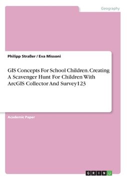
portada GIS Concepts For School Children. Creating A Scavenger Hunt For Children With ArcGIS Collector And Survey123 (en Inglés)
Formato
Libro Físico
Editorial
Idioma
Inglés
N° páginas
32
Encuadernación
Tapa Blanda
Dimensiones
21x14.8x0.2 cm
Peso
0.05 kg.
ISBN13
9783346220233

GIS Concepts For School Children. Creating A Scavenger Hunt For Children With ArcGIS Collector And Survey123 (en Inglés)

Philipp Straßer (Autor) · Eva Missoni (Autor) · Grin Verlag · Tapa Blanda

GIS Concepts For School Children. Creating A Scavenger Hunt For Children With ArcGIS Collector And Survey123 (en Inglés) - Straßer, Philipp ; Missoni, Eva

Libro Nuevo Importado
Envío: 20 a 24 días háb.
$ 187.028$ 102.865
-45%
Costos de importación incluídos en el precio ✅
Libro Nuevo

Quedan 10 unidades

$ 102.865
¡Envío Gratis!  Llega entre el 16 Sep y el 23 Sep a Bogota, Cundinamarca. Seleccionar ubicación

Reseña del libro "GIS Concepts For School Children. Creating A Scavenger Hunt For Children With ArcGIS Collector And Survey123 (en Inglés)"

Academic Paper from the year 2019 in the subject Geography / Earth Science - Cartography, Geographic Information Science and Geodesy, grade: 1, University of Salzburg (ZGIS), language: English, abstract: This paper presents a scavenger hunt. A scavenger hunt can be a ludic and active approach to address pupils and transport educational and subject content. Thus, this scavenger aims to familiarize pupils of the age class 10-12 years with GIS and the possibilities GIS offer in a playful manner. It includes 5 stations which are addressed by following an instruction-sheet with QR-codes leading to the respective places and posing questions and tasks. For the scavenger hunt there are two datasets that must be handled: The tasks for each station including the submitted answers and the tracks of the groups. The results and the tracks should also be made available to the Z_GIS geoportal following the guidelines of open standards and interoperability. To fulfill these requirements a combination of two ESRI software products was used: ArcGIS Collector and Survey123. The tracks can be accessed as web feature service via REST URL whereas the survey answers are directly integrated into a dashboard with a map. So, the results are immediately updated and available in ArcGIS Online for inspection, comparison and discussion.

Opiniones del libro

Preguntas frecuentes sobre el libro

Todos los libros de nuestro catálogo son Originales.
El libro está escrito en Inglés.
La encuadernación de esta edición es Tapa Blanda.

Preguntas y respuestas sobre el libro

¿Tienes una pregunta sobre el libro? Inicia sesión para poder agregar tu propia pregunta.

Opiniones sobre Buscalibre

Ver más opiniones de clientes