Enviar a
Bogota, Cundinamarca
0
  • argentina
  • chile
  • colombia
  • españa
  • méxico
  • perú
  • estados unidos
  • internacional

Selecciona tu país

América

Europa

Resto del mundo

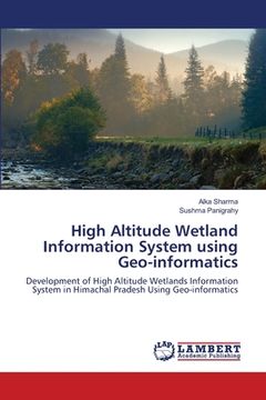
portada High Altitude Wetland Information System using Geo-informatics (en Inglés)
Formato
Libro Físico
Idioma
Inglés
N° páginas
60
Encuadernación
Tapa Blanda
Dimensiones
22.9 x 15.2 x 0.4 cm
Peso
0.10 kg.
ISBN13
9786139849000

High Altitude Wetland Information System using Geo-informatics (en Inglés)

Alka Sharma (Autor) · Sushma Panigrahy (Autor) · LAP Lambert Academic Publishing · Tapa Blanda

High Altitude Wetland Information System using Geo-informatics (en Inglés) - Sharma, Alka ; Panigrahy, Sushma

Libro Nuevo Importado
Envío: 20 a 24 días háb.
$ 293.494$ 146.747
-50%
Costos de importación incluídos en el precio ✅
Libro Nuevo

Quedan 10 unidades

$ 146.747
¡Envío Gratis!  Llega entre el 31 Ago y el 07 Sep a Bogota, Cundinamarca. Seleccionar ubicación

Reseña del libro "High Altitude Wetland Information System using Geo-informatics (en Inglés)"

This report summarizes mapping of High Altitude Wetlands (HAWs) and creating a geospatial data base in state of Himachal Pradesh at 1:50,000 scale using remote sensing data which would help in planning maintenance and conservation of special wetlands and play significant role in the hydrological cycle and water resources of the state. The Indian Remote Sensing Linear Imaging Self Scanning (IRS P6 LISS III) digital data having four spectral bands: Green, Red, Near Infra-Red (NIR) and Short Wave Infra-Red (SWIR) with spatial resolution of 24 m was used for mapping of wetlands. The Digital Elevation Model (DEM) derived from Shuttle Radar Topography Mission (SRTM) data was used to classify the lakes as per altitude range. Wetland layers comprising Wetland extent, Open-water extent and Aquatic vegetation extent have been generated for each wetland. A classification system based on International Union for Conservation of Natural Resources (IUCNR) and amenable from satellite data was used to categorize the wetlands. A Total of 19 types of wetlands were delineated using a hierarchical system. High Altitude Wetlands is one of the classes mapped, which is first such attempt in the India.

Opiniones del libro

Preguntas frecuentes sobre el libro

Todos los libros de nuestro catálogo son Originales.
El libro está escrito en Inglés.
La encuadernación de esta edición es Tapa Blanda.

Preguntas y respuestas sobre el libro

¿Tienes una pregunta sobre el libro? Inicia sesión para poder agregar tu propia pregunta.

Opiniones sobre Buscalibre

Ver más opiniones de clientes