Compartir
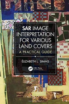
Sar Image Interpretation for Various Land Covers: A Practical Guide (en Inglés)
Elizabeth L. Simms (Autor)
·
Crc Press
· Tapa Dura
Sar Image Interpretation for Various Land Covers: A Practical Guide (en Inglés) - Elizabeth L. Simms
$ 461.176
$ 709.501
Ahorras: $ 248.325
Elige la lista en la que quieres agregar tu producto o crea una nueva lista
✓ Producto agregado correctamente a la lista de deseos.
Ir a Mis Listas
Origen: Estados Unidos
(Costos de importación incluídos en el precio)
Se enviará desde nuestra bodega entre el
Lunes 15 de Julio y el
Miércoles 31 de Julio.
Lo recibirás en cualquier lugar de Colombia entre 1 y 5 días hábiles luego del envío.
Reseña del libro "Sar Image Interpretation for Various Land Covers: A Practical Guide (en Inglés)"
This full color book is a comprehensive visual reference for the interpretation of synthetic aperture radar (SAR) images with examples of how technological specifications may affect interpretation solutions. It contains a summary review of image acquisition parameters of consequence on the visual representation of objects, introduces traditional interpretation keys under different light and applies them for considering regional landscape components and identifying large-scale geographical ensembles. Through elements of interpretation such as the construct of tone, texture, pattern, size, and shape, the book explains the rich unique context of many terrains. It provides also several SAR X- and C-band image examples of regional and large-scale land use and land cover (LULC) ensembles, includes important explanations for each illustration, and highlights selected SAR image applications. Ancillary information includes acquisition specifications, a geographic scale, and the image-center latitude and longitude. Features: Provides ready access to any type of information for an image interpretation problem related to current LULC classification schemes. Presents scalable geographic information interpreted at a regional scale and land cover ensembles that can also be interpreted locally. Provides comparative examples of images acquired from X- and C-band, opposed look directions, near- and far-range incidence angles, like- and cross-polarization modes. Includes practical explanations easily transferred to individual’s research projects. Designed as "visual dictionary," SAR Image Interpretation for Various Land Covers: A Practical Guide, is an excellent introduction to the visual interpretation of SAR images for numerous types of LULC. Both practitioners and students will familiarize themselves with and expand their knowledge of geographic information conveyed from radar images while government agencies and businesses that use LULC-related data for emergency response cases of for urban and regional planning, will find this book invaluable.
- 0% (0)
- 0% (0)
- 0% (0)
- 0% (0)
- 0% (0)
Todos los libros de nuestro catálogo son Originales.
El libro está escrito en Inglés.
La encuadernación de esta edición es Tapa Dura.
✓ Producto agregado correctamente al carro, Ir a Pagar.

